The highest point in South Dakota, this peak has been the site of visions and majesty for centuries.
When he was only nine years old, a boy named Black Elk had a vision:
“Then I was standing on the highest mountain of them all, and round about beneath me was the whole hoop of the world. And while I stood there I saw more than I can tell and I understood more than I saw; for I was seeing in a sacred manner the shapes of all things in the spirit, and the shape of all shapes as they must live together like one being.”
It was the first vision to ever come to the future Lakota leader, and it all happened on the peak that now bears his name.
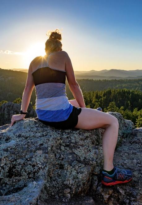
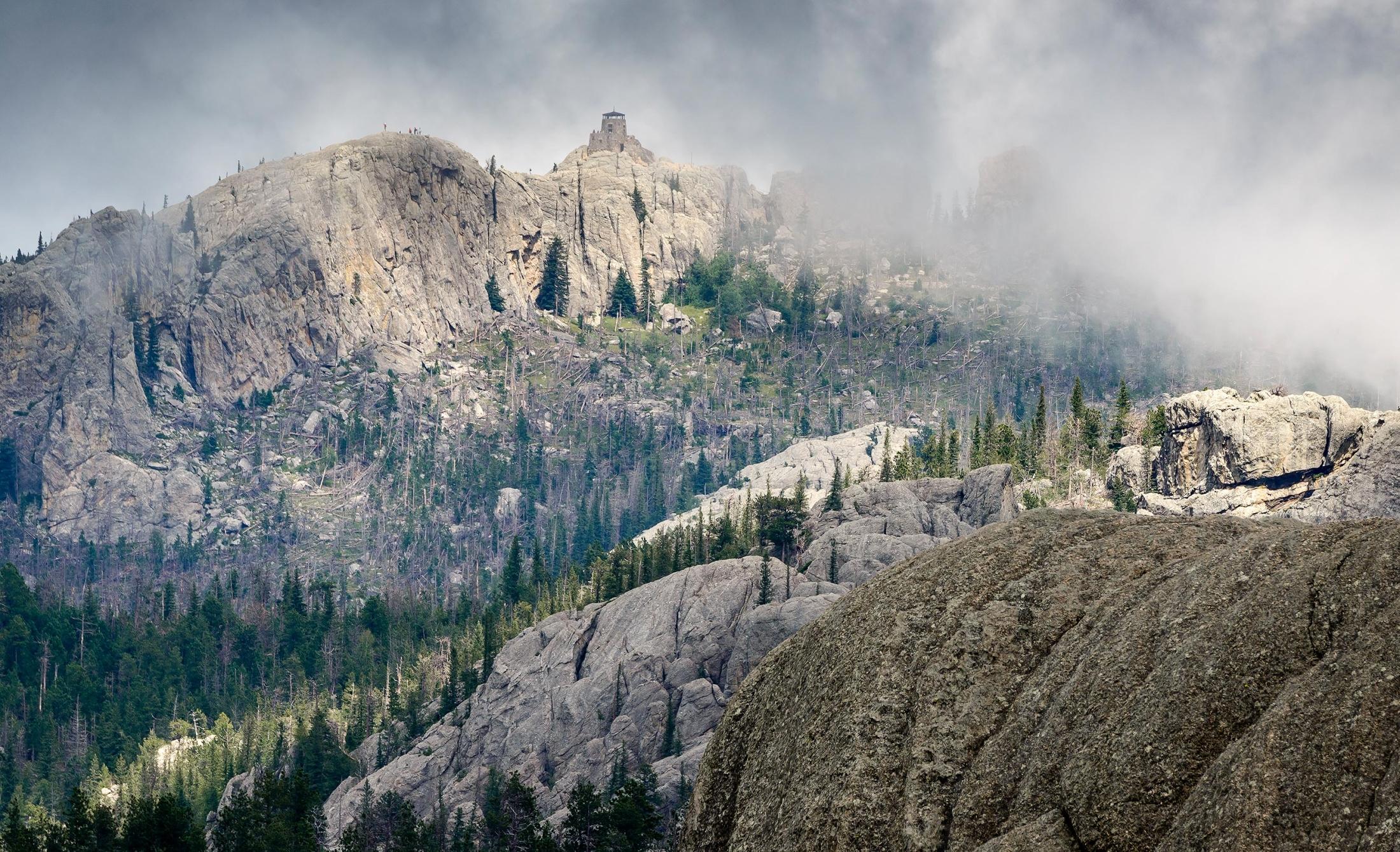
At 7,242 feet, Black Elk Peak — previously known as Harney Peak — isn’t just the highest point in South Dakota. It’s the highest elevation between the Rocky Mountains in the western United States and the Pyrenees Mountains in France. Surrounded by the beautiful Black Elk Wilderness in Custer State Park, Black Elk Peak is one of the most popular outdoor sites in the state. Hikers of all ages make their ascent to take in a view that seems to extend forever and includes gorgeous views of South Dakota, Wyoming, Montana, Nebraska and North Dakota.


Popular Black Elk Peak Trails
One of the best things about Black Elk Peak is the number of options for getting to the top. There are more than a dozen ways to make the ascent. Ready to start exploring? Here are some of the most popular hiking options, including directions, elevations and approximate hiking times.
Please note that times and distances are approximate. Difficulty is based on Forest Service difficulty rankings.
Sylvan Lake #9
Round-trip distance: 7 miles
Round-trip time: 2-4 hours
Elevation: 1,100 feet
Difficulty: Difficult going up, moderate coming down
Directions: The trailhead is easy to locate from the parking lot beside Sylvan Lake. It is the most traveled and shortest route to Black Elk Peak.
Please note that this route requires paid entry into Custer State Park.
Little Devils Tower #4
Round-trip distance: 7 miles
Round-trip time: 2-4 hours
Elevation: 1,100 feet
Difficulty: Moderate to strenuous, ending with a scramble to the top of Little Devils Tower
Directions: Little Devils Tower sits 200 feet lower than its famous neighbor in Wyoming, but has plenty of its own charm. After scrambling up the rock, hikers can see the famous Cathedral Spires (granite needles that stretch to the sky) as well as Black Elk Peak’s fire tower and the backside of Mount Rushmore. Including Little Devils Tower does add some time to your pursuit of Black Elk Peak, but many wouldn’t consider making the hike any other way.
The trail leaves the Sylvan Lake area and meets up with two spur trails that lead to Cathedral Spires and Little Devils Tower. You can access the trailhead at the Sylvan Lake parking lot or drive further up the Needles Highway (Highway 87) past the Sylvan Lake Campground to the trailhead marked Little Devils Tower, which connects with Trail #4 and shortens the hike by approximately a ½-mile round-trip. The trailhead is 1 mile east of Sylvan Lake on South Dakota Highway 87. Take Trail #4 to #3 and, later, #9.
Please note that this route requires paid entry into Custer State Park.
Willow Creek Trail #9
Round-trip distance: 12.6 miles
Round-trip time: Approximately 8 hours
Elevation: 2,200 feet
Difficulty: Moderate to difficult
Directions: This trail is popular with hikers for its interesting rock formations and, often, fewer people. The trailhead is found along SD-244 approximately 6 miles west of Mount Rushmore. Head past the large map sign to a grass parking lot. The sign Trail #8 will be next to the large sign at the far end of the lot. Follow the route to the left until you connect with Black Elk Peak Trail #9. If you want to make a loop, hike south on Trail #9 from the summit of Black Elk Peak before taking Lost Cabin Trail #2 to Willow Creek Horse Camp.
Norbeck Trail #3
Round-trip distance: 10 using Norbeck Trailhead, 14 using Iron Creek Horse Camp
Elevation: 2,076 feet
Difficulty: Moderate
Directions: The Norbeck Trailhead is accessible from Forest Road 345 approximately 8 miles southeast of Sylvan Lake on the Needles Highway. Take the trail to Trail #9 and then head for the summit. Iron Creek Horse Camp is approximately 8 miles east on Needles Highway and a short drive up Forest Road 345. From Norbeck Trail #3, hike until you connect with Trail #9.
Grizzly Bear Trail #7
Round-trip distance: 12.6 miles
Elevation: 1,500 feet
Difficulty: Moderate to difficult
Directions: The trailhead is accessible from Forest Road 345 approximately 8 miles southeast of Sylvan Lake on the Needles Highway (or 1 mile north of Iron Creek Horse Camp on 345). Take Grizzly Bear Creek Trail #7 to either Trail #3 or Trail #9 and then head to the summit.
Cathedral Spires Trailhead #4A
Round-trip distance: 7 miles
Difficulty: Difficult with a scramble to the top of Little Devils Tower
Directions: The trailhead is 2 miles east of Sylvan Lake on Needles Highway. Take that trail and link up with Trail #4 to end up finding Black Elk Peak Trail #9.
Horsethief Lake
Round-trip distance: 2.7 miles, but can be extended to 13 miles
Difficulty: Moderate
Directions: Horsethief Lake Trailhead can be found approximately two miles west of Mount Rushmore National Memorial on state Highway 244. Begin your hike at Horsethief Lake Trail #14 and then take Grizzly Bear Creek Trail #7, Norbeck Trail #3 and Black Elk Peak Trail #9.
Lost Cabin Route
Round-trip distance: 13 miles
Difficulty: Moderate to difficult
Directions: Drive 1/3 mile west of the Mount Rushmore KOA at Palmer Gulch on Highway 244. Continue approximately 1 mile on Palmer Creek Road/Country Road 357 to find Palmer Creek Trailhead. Take Lost Cabin Trail #2 to Black Elk Peak Trail.


Tips for Hiking Black Elk Peak
- As with any hike, it’s important to map out your journey and prepare appropriately. View a Black Elk Peak map that includes hiking information and trailheads to start planning your visit.
- Make sure you consider the temperature as you plan your hike.
- Travel with plenty of water to ensure a safe journey to the peak and back. Many hikers also pack a picnic lunch, as Black Elk Peak offers some grassy areas that are perfect for plopping down and resting up with some food and a beverage. Be prepared to meet some very friendly chipmunks who might appreciate a bite or two of your meal.
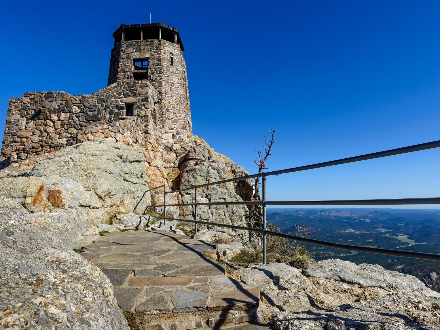
- The peak features a stone fire tower built by the Civilian Conservation Corps in 1938. That the tower remains is a testament to the quality of the craftsmanship and the work that went into its construction. The stone, cement and sand were hauled up more than three miles by carts pulled by horses and mules. Although the fire tower was decommissioned in 1967, it’s still a welcome sight for hikers who make the trip to Black Elk Peak.
Great trails are all over the Black Hills, but there’s only one Black Elk Peak. No matter which route you take, prepare yourself for an exhilarating trip and a view you’ll never forget.