
Life’s about the journey. South Dakota's diverse landscape, iconic monuments, national parks and natural wonders make it the perfect road trip. Scenic byways take travelers through the otherworldly formations of the Badlands to world-famous monuments like Mount Rushmore National Memorial. From tribal lands steeped in rich Indigenous history, where spiritual leaders like Sitting Bull now rest, to Custer State Park, where the buffalo still roam free, we encourage you to take the scenic route and let life happen between the mile markers.
Breathtaking Byways
Peter Norbeck National Scenic Byway
Some of the most incredible roads anywhere make up the Peter Norbeck National Scenic Byway, named one of America's 10 Most Outstanding Byways. Spiraling bridges and hairpin curves lead drivers to Custer State Park, Mount Rushmore National Memorial and several other iconic Black Hills attractions. Mix in tunnels through granite pinnacles, beautiful mountain lakes and free-roaming wildlife for a never-to-be-forgotten road trip.

Native American National and State Scenic Byway
The Native American National and State Scenic Byway, running north and south through central South Dakota, reveals breathtaking views of the Missouri River, diverse landscapes, and tribal history and culture. This byway travels through the lands of the Yankton, Crow Creek, Lower Brule, Cheyenne River and Standing Rock Sioux Tribes.

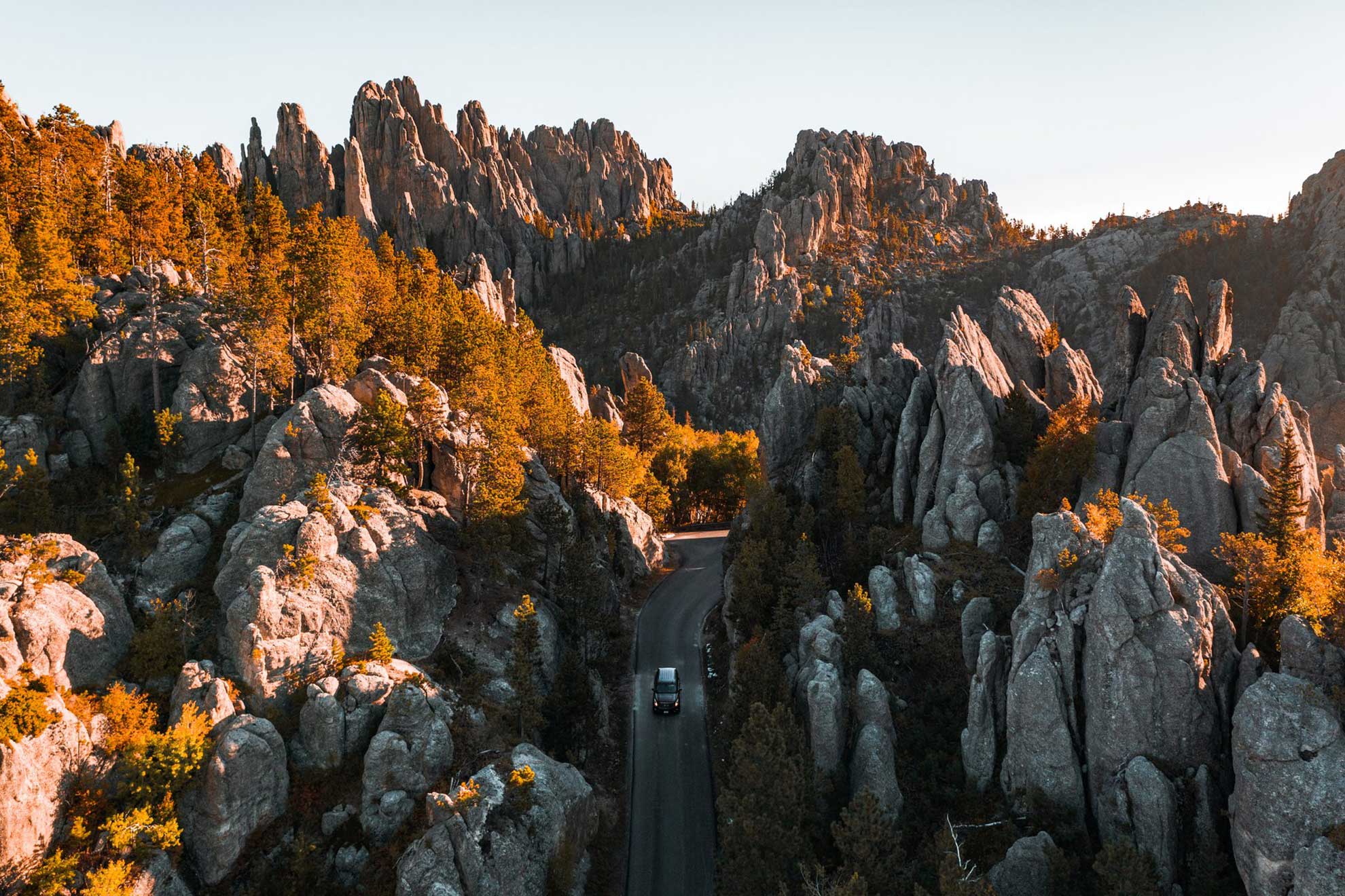
Spearfish Canyon State and National Forest Service Scenic Byway
Following the contours of Spearfish Creek, this 19-mile scenic byway winds between cliff walls lined with spruce, pine, aspen, birch and oak trees. That’s why this popular Black Hills route is consistently named one of North America’s best fall drives. Along the way, travelers will find waterfalls, outstanding hikes, trout-filled pools, hidden swimming holes and climbing spots.

Wildlife Loop State Scenic Byway
Wind through pine-covered hills, rolling prairies and red-walled canyons. Experience a traffic jam caused by buffalo, meet the popular "beggin’ burros" or spot bighorn sheep, pronghorn antelope, deer, elk, coyote, prairie dog and numerous bird species on the Wildlife Loop. This 18-mile scenic byway is a highlight of a park that leaves many blown away by nature’s beauty.

Badlands Loop State Scenic Byway
Some describe Badlands National Park as lunar-like. Indigenous people first named it "mako sica" or "bad lands." This 39-mile loop guarantees more than one stop, with breathtaking rock formations, otherworldly hiking trails and 16 designated scenic overlooks.
Keep Exploring


Unexpected South Dakota

Join renowned adventurer, biologist and TV host Forrest Galante on an unexpected South Dakota road trip, where his curiosity leads him to hidden gems and unforgettable locals who bring the state to life.
In partnership with Matador Network and Jeep®, Travel South Dakota is excited to bring you this new series. Click below to explore the episodes — or catch them on Roku, where the full series is available.
See What's Waiting on the Road in South Dakota
Get inspired and say #HiFromSD!


